Fieldwork in Chile #4 | What does lithium mining mean for nature?
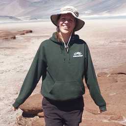
Students and professors of the UvA research group Mining for the Energy Transition are visiting the Atacama salt flats in Chile this spring, the place with the largest lithium reserves in the world. For Folia, several group members are reporting on their trip. This week it’s Paulien Deken (22), master’s student in Earth Sciences. “The Chilean government has a rather passive role in monitoring the environment and leaves this to the mining companies themselves.”

One of the biggest concerns in the lithium debate in the Salar de Atacama salt flats is about the potential impact of separating large amounts of saline groundwater, as the impact on the fragile ecosystem is not yet clear. This is where the earth science contribution to the project comes in.

Together with fellow earth scientist Minnert, we are using remote sensing to look at changes in the landscape since the start of lithium mining. We use publicly available satellite images to observe trends over time and in the landscape, for example, in vegetation patterns and water surfaces.
We also use information on the chemical composition of the lake water, soil infiltration rates, and organic matter levels to explain trends. Our plan was to obtain this data by taking water and soil samples in the Salar.
In good spirits, we left for San Pedro de Atacama with an elaborate plan. We knew in advance that obtaining permits to take soil and water samples would be difficult because of the involvement of various local communities and parties. But it turned out fairly quickly that it would not only be difficult, but impossible.

The politicized situation meant that we had to change our plan and instead make observations of changes in soil and vegetation along different transects in the Salar. Unfortunately, I was not familiar with botany and certainly not with the Latin names. With our guide, Dr. Carina Hoorn, we then took a crash digital botany course and spent a day with a local ethnobotanist. While visiting one of the lagoons, we met a local guide who was eager to accompany us to tell us more about the local plants.
We picked him up the next day. Not only did we see new plants, we also learned what his ancestors used the plants for. For example, the presence of the baltic rush (a grasslike plant) was an indication of underground drinking water, rica ricate helps against stomach aches, and you can make delicious soup and omelets from the cachiyuyo.
In addition to the tour with the local guide, we drove around each day mapping the area, taking notes, and explaining differences in vegetation on both sides of the main road. The wetlands scattered here and there throughout the Salar are a unique sight in the otherwise bone-dry desert.
The energy transition requires large amounts of raw materials. But clean energy technologies require far more metals and minerals than working with fossil fuels such as petroleum and coal. As the demand for “cleaner” resources increases, social and environmental tensions arise where these resources are extracted. The same is true of lithium, a light metal used to produce batteries for electric vehicles and power grids. Demand for lithium is expected to continue to grow in the coming decades.
The Mining for the Energy Transition research project is interdisciplinary and looks at economic, environmental, technological, social, political, and business aspects of the energy system, energy transition, and sustainable goals. The research project is funded by ENLENS (Energy transition through the lens of Sustainable Developments Goals), one of UvA's interfaculty research priorities.
It can be explained by the geological configuration right next to the Andes and the underground and surface water flows associated with it. These kinds of local observations are incredibly valuable because on satellite images at home behind our computer, it is difficult for us to figure out what is really there on a 30-by-30-meter pixel image.
Another challenge for our research was obtaining independent data. The Chilean government has a rather passive role in environmental monitoring, leaving it to the mining companies themselves. In our search for additional data from outside parties, we ended up with, among others, the Universidad Católica del Norte, a local university that also does research in the Salar de Atacama.
Following e-mail contact, it turned out that they were very interested in our research. We visited their campus in Antofagasta, the regional capital located four hours away through a very dry desert. Here we presented our research and met with the geology department. This meeting was not only to obtain data but also to strengthen ties with another university for a possible collaboration in the future.
Now the fun part of our research is almost over. Soon in Amsterdam, the hours at the computer will begin and we will be able to put our acquired knowledge into practice.
Next week read episode 5, the last of our series, Fieldwork in Chile. You can read episode 3 here.
.jpg)